Before
The Grid
The
1811 Plan
BUILDING
THE GRID
19TH-CENTURY
DEVELOPMENT
20th century–
Now
living on
the grid
other
Grids
Living on The Grid

“Manhattan has no
center … If you asked a New Yorker for directions to ‘the center of town,’ he would be bewildered.”
Although the Commissioners’ Plan created the Manhattan grid by delineating only two elements, the streets and the blocks, the grid affects almost all aspects of urban life. Infrastructure and architecture make the grid; utilities, transportation networks, and social patterns follow it.
Because the grid was laid out over a relatively unpopulated area, the systems that support the metropolis developed in tandem with the grid and assumed its shape. Communications systems, power supply, and train lines initially were all above ground until the late 19th century, when they were buried underground, following the pattern of the grid. Read More
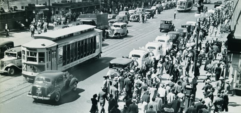
Subways echo the grid underground; the rest of the transportation network echoes it at street level. Because of the original emphasis on waterfront access, the grid provided many more crosstown streets, and travel up and down the island was concentrated on relatively few avenues. In 1949 the Department of Traffic Engineering developed the one-way traffic system in part to address the limited capacity of the avenues and make north–south transit more efficient, and an automated traffic light system was designed to allow traffic to move through several intersections without stopping.
Not just vehicular traffic, but pedestrians, too, are obliged to follow the grid. The area designated for them, the sidewalk, connects the streets and buildings of the grid spatially and is legally associated with both: though owned by the city, the sidewalk is used and maintained by property owners.
Sidewalks are not only a transit zone to get from point A to point B; they provide a space for social activity, and corners especially are natural gathering places. Jane Jacobs, champion of streets as social space, preferred shorter blocks than the ones created by the 1811 plan: more intersections mean more corners, and more opportunities for human interaction.
For pedestrians moving through neighborhoods, the grid’s regular numbering system—as opposed to named streets—makes it easy to navigate, and the distances between the blocks allow walkers to calculate travel time with simple rules of thumb: twenty short blocks to a mile, one block a minute. The grid is not just the physical fabric of the city; the grid also is the systems and people moving through it. Show Less
