Before
The Grid
The
1811 Plan
BUILDING
THE GRID
19TH-CENTURY
DEVELOPMENT
20th century–
Now
living on
the grid
other
Grids
Before the Grid.
The Mangin-Goerck Plan, 1803
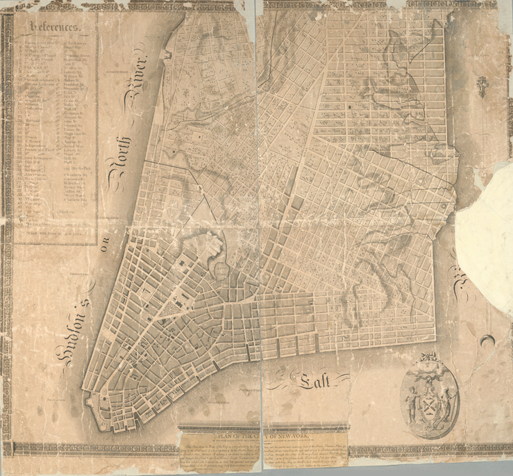

Plan of the City of New York /drawn from actual survey by C[a]simir Th. [G]oerck, and Joseph Fr. Mangin, city surveyors, 1803
The Lionel Pincus and Princess Firyal Map Division, The New York Public Library, Astor, Lenox and Tilden FoundationsIn 1797 the Common Council hired Common Lands mapmaker Casimir Goerck and fellow city surveyor Joseph François Mangin to make the first official post-Revolution map of the city. Goerck died in the 1798 yellow fever epidemic, and the resulting map was largely the work of Mangin.
The map conveyed Mangin’s ideas about how to organize the city’s disorderly street pattern: he straightened the colonial streets, placed new streets on river landfill, and proposed a patchwork of small, rectilinear grids at varying angles north of the city proper. The Common Council rejected his map, ordering subscription copies destroyed. Only a handful of copies survive; the original six-foot-square manuscript map disappeared long ago.
Mangin’s map, despite its rejection, prompted the city to begin thinking about its street system and stimulated the establishment of the street commission four years later, which led to the iconic grid. GK