Before
The Grid
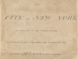
The
1811 Plan
BUILDING
THE GRID
19TH-CENTURY
DEVELOPMENT
20th century–
Now
living on
the grid
other
Grids
The 1811 Plan
John Randel, Jr.
In 1807 the commissioners appointed John Randel, Jr. as their secretary and surveyor. Over a period of 14 years, from 1807 to 1820, when he completed a detailed atlas of the island, the Randel Farm Maps, he was responsible for surveying the island and outlining the streets. Randel’s first wave of surveying informed the 1811 plan: his work is reflected in the elevation notations, the varying distances between the avenues, the unvarying 200-foot width of the blocks, and the hierarchy of street widths. Read More In the next phase of work for the Common Council, Randel meticulously resurveyed the island, placing stone monuments at the location of future streets and recording the properties and natural features that the grid would have to reorganize. Show Less
The farm maps, as they have come to be called, drawn up by John Randel, Jr., portray early-19th-century Manhattan in stunning and rare detail, at a scale of 100 feet to... Read More
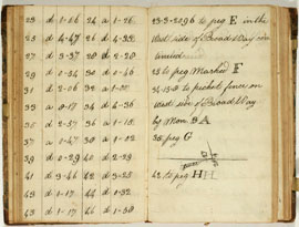
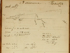
The process of accurately determining block length was quite involved. These pages from an 1811 field book show measurements of angles of ascent and descent, apparently... Read More
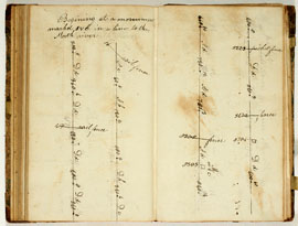
This page is headed by Randel’s note: “Beginning at a monument marked FVC” [and continuing] “in a line to the North river.” Randel is here surveying a future street from... Read More
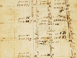
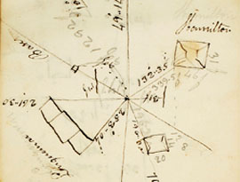
Randel’s thoroughness is on display on this page that shows him double-checking measurements to assure that the avenues are straight and parallel. On the left page... Read More
Randel took pride in the precision of his instruments and the resulting measurements. Here he adjusts a chain. “Friday February 9th. The chain on being examined is found... Read More
The top page of this spread shows a diagram where Randel notes a crucial distinction in surveying. When a surveyor plumbs up his sighting device and looks forward, he is... Read More
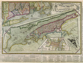
This map is a testimonial to Randel’s surveying art. He organized the picture as three superimposed maps, with the gridded island of New York placed in a regional... Read More