Before
The Grid
The
1811 Plan
BUILDING
THE GRID
19TH-CENTURY
DEVELOPMENT
20th century–
Now
living on
the grid
other
Grids
Before the Grid
Fort Washington
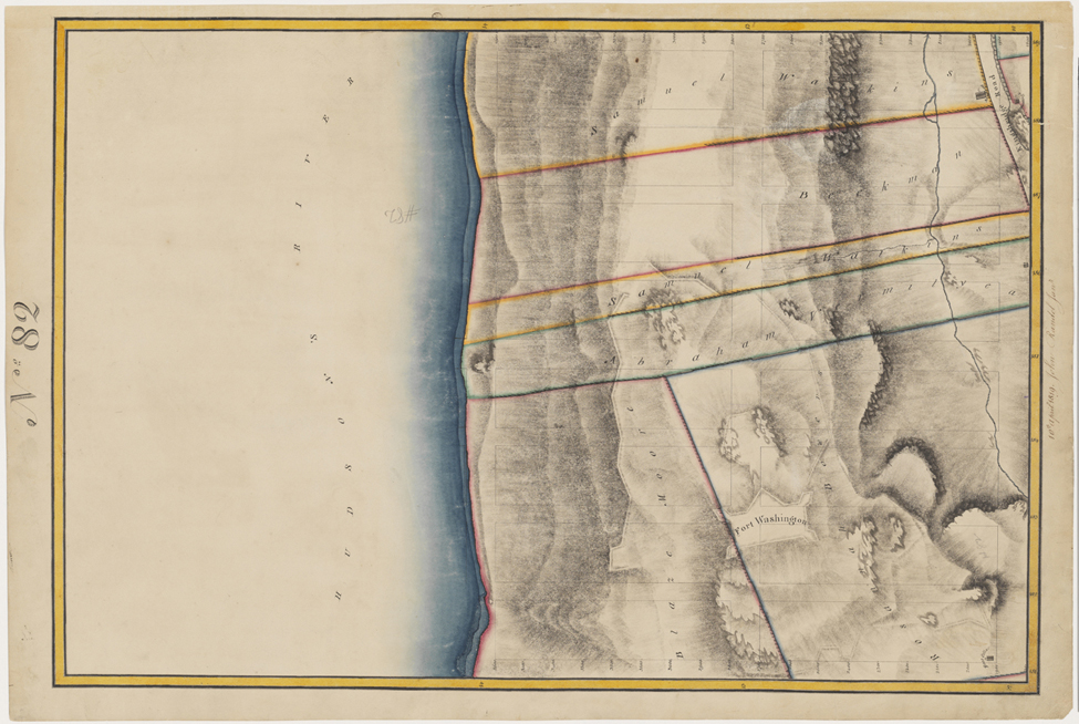

Image 3
Randel Farm Map no. 82, vol. 4, p. 23, showing 181st to 189th Street, from Twelfth Avenue to the Hudson River, April 10, 1819. Pen and ink with watercolor on paper
Used with permission of the City of New York and the Office of the Manhattan Borough PresidentThis map depicts the area a few blocks north of where the George Washington Bridge now spans the Hudson River, at West 178th Street. The area has some of Manhattan’s highest elevations, which explains why Fort Washington was built here to defend the city against the British during the Revolutionary War. Although the Randel Farm Map shows the outlines of city blocks on the steep hills and pre-existing property lines at the north end of the island, the 1811 grid plan only extended to 155th Street, in part due to the rugged terrain in northern Manhattan. RR
© 2015 Museum of the City of New York all rights reserved