Before
The Grid
The
1811 Plan
BUILDING
THE GRID
19TH-CENTURY
DEVELOPMENT
20th century–
Now
living on
the grid
other
Grids
Before the Grid
Creek and Marsh
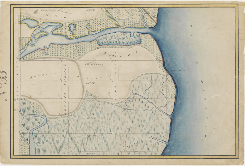


Randel Farm Map no. 55, vol. 1, p. 16, showing 101st to 109th Street, from Third Avenue to the East River, July 21, 1820. Pen and ink with watercolor on paper
Used with permission of the City of New York and the Office of the Manhattan Borough PresidentThe gridded streets and avenues of the Commissioners’ Plan were overlaid upon hills and wetlands alike. However, the commissioners did set aside an area on the East Side between 106th and 109th Streets for a salt marsh where the Harlem Creek flowed out into the East River, as shown here in one of the Randel Farm Maps. Part of the Harlem Marsh, this semi-tidal creek extended more than halfway across the island from Manhattanville in West Harlem all the way to the East Side. One of Manhattan’s most significant streams at the turn of the 19th century, the Harlem Creek was an estimated 100 feet in width and 20 feet deep at its confluence with the East River. As the city expanded northward, both the creek and surrounding marshlands were eventually converted into rectangular city blocks. RR