Before
The Grid
The
1811 Plan
BUILDING
THE GRID
19TH-CENTURY
DEVELOPMENT
20th century–
Now
living on
the grid
other
Grids
Before the Grid.
18th-Century City
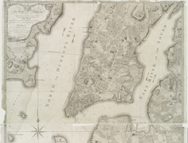
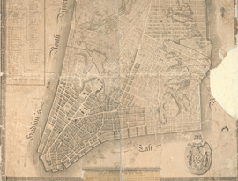
This map, by British army officer Bernard Ratzer, is the most accurate depiction of New York in its late colonial days. At the southern tip of Manhattan are the narrow... Read More
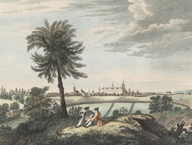
The print evokes the bucolic nature of Manhattan in the mid-18th century. Today, this spot lies roughly at the intersection of Varick and Beach Streets. Read More
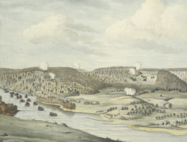
From present-day University Heights in the Bronx, the artist looks west across the Harlem River as Hessian forces take part in a successful assault to... Read More
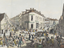
Five Points is the picture of what the grid commissioners were trying to avoid. Had the grid not happened, intersections like Five Points might have sprouted... Read More
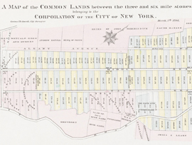
The municipality’s landholdings, known as the Common Lands, encompassed about two square miles in central Manhattan, from today’s 23rd to 90th Street between Second and... Read More
In 1797 the Common Council hired Common Lands mapmaker Casimir Goerck and fellow city surveyor Joseph François Mangin to make the first official post-Revolution map... Read More