Before
The Grid
The
1811 Plan
BUILDING
THE GRID
19TH-CENTURY
DEVELOPMENT
20th century–
Now
living on
the grid
other
Grids
Building the Grid: From Paper to Street, Block and Lot
Astor’s Midtown Property, 1819
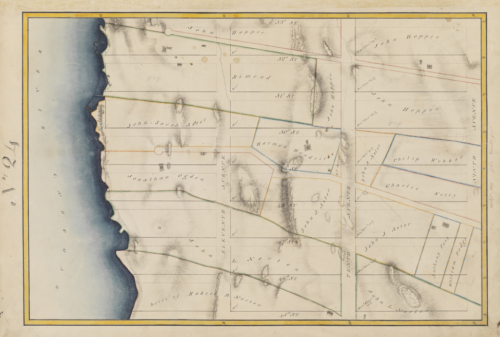


Image 2
Randel Farm Map no. 24, vol. 4, p. 6, showing 45th to 53rd Street from Ninth Avenue to the Hudson River, September 20, 1819
Used with permission of the City of New York and the Office of the Manhattan Borough PresidentIn the middle of this Randel Farm Map, John Jacob Astor’s properties are outlined in orange. Tenth Avenue and the cross streets from 47th to 50th have cut one property into 10 parts, including a snippet at the southwest corner of 47th Street. Eleventh Avenue divides the other property into four parts. These irregular parcels were incompatible with the lot and block system of the grid; to rectangularize them would require other real estate transactions. Indeed, the slicing of Astor’s property suggests how the grid radically reorganized property ownership.
© 2015 Museum of the City of New York all rights reserved