Before
The Grid
The
1811 Plan
BUILDING
THE GRID
19TH-CENTURY
DEVELOPMENT
20th century–
Now
living on
the grid
other
Grids
19th-Century Development
Union Place, Gramercy Park and Lexington Avenue: Samuel Ruggles’s Property, 1831
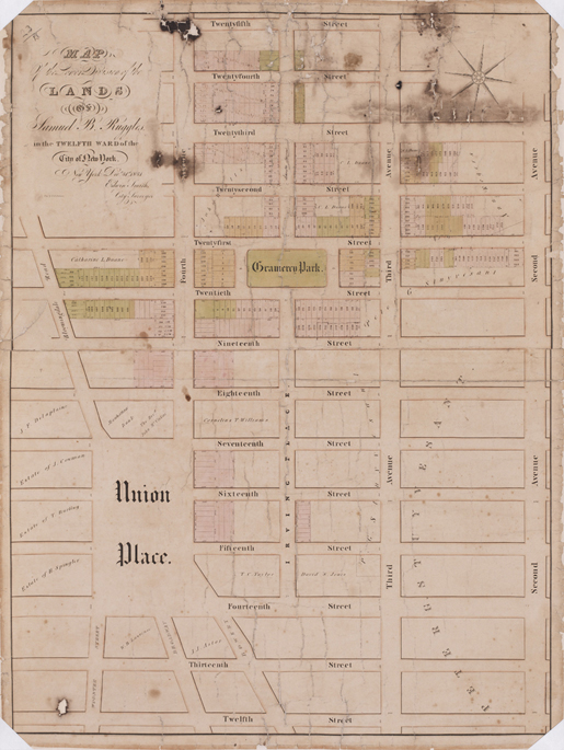


Image 14
Edwin Smith, “Map of the Lower Division of the Lands of Samuel B. Ruggles in the Twelfth Ward in the City of New York,” December 31, 1831. Engraving by D.R. Harrison
Museum of the City of New York, The J. Clarence Davies Collection, 29.100.2973This larger scale map of Ruggles’s property shows the relationship of the Gramercy development and Union Place. Ruggles created Irving Place between Third and Fourth Avenues from 14th to 20th Street to provide access to his development at Gramercy Park. On the north side of the square, the new avenue was called Lexington Avenue.
© 2015 Museum of the City of New York all rights reserved