Before
The Grid
The
1811 Plan
BUILDING
THE GRID
19TH-CENTURY
DEVELOPMENT
20th century–
Now
living on
the grid
other
Grids
19th-Century Development
Union Place, 1819
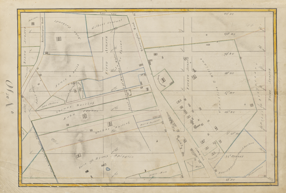


Randel Farm Map no. 10, vol. 2, p. 2, showing 13th to 21st Street, from Third Avenue to Sixth Avenue, 1819. Pen and ink with watercolor on paper
Used with permission of the City of New York and the Office of the Manhattan Borough PresidentThis Randel Farm Map encompasses the area bounded by Third and Sixth Avenues from 13th to 21st Street. Interrupting the grid at the bottom of the drawing is the triangular Union Place, which is occupied by many small structures. The Commissioners’ Plan of 1811 preserved three early roads—the Bowery, Broadway, and Bloomingdale Road—and called their elongated, irregularly shaped intersection Union Place. (Union refers to the union of these roads.) The site had been a burial ground for indigents, which accounts in part for its preservation. The Bowery runs along the east side of Union Place, and Bloomingdale Road on its west side. Manhattan Bank occupies a well trafficked site, at the top Union Place, where the two old streets converge. Peter Stuyvesant’s property is cut off in the lower right corner and extends along Third Avenue. On the left side, near 17th Street, is a property owned by John Jacob Astor; the new streets would dismember this property.