Before
The Grid
The
1811 Plan
BUILDING
THE GRID
19TH-CENTURY
DEVELOPMENT
20th century–
Now
living on
the grid
other
Grids
19th-Century Development
Above 155th Street: Extending the Grid
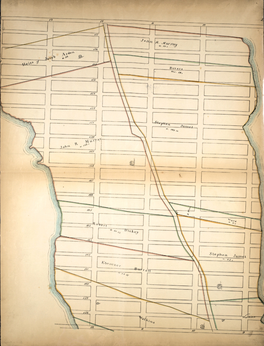


From the Sackersdorff Farm Set, p. 23: Bounded by W. 177th Street, Harlem River, W. 157th Street and Hudson River, 1868
The Lionel Pincus and Princess Firyal Map Division, The New York Public Library, Astor, Lenox and Tilden FoundationsThis map, drawn in 1868, records an impulse to extend north of the commissioners’ original boundary line at 15th Street.
City surveyor Otto Sackersdorff copied the Randel Farm Maps and published them in 1868 in a collection known as the Sackersdorff Blue Book. Although the commissioners stopped the grid at 155th Street, Randel projected it up the entire island, and the Sackersdorff maps show that extension as well. This Sackersdorff map of the area between the proposed 157th and 177th Streets fails to show topography, a dangerous omission when dealing with the undulating grid-defying terrain of northern Manhattan. Studying these maps one would never realize, for example, that steep drop-offs dominate the Hudson and Harlem River shorelines, and that a large bump in the landscape, Marble Hill, crowns the tip of the island. MM