Before
The Grid
The
1811 Plan
BUILDING
THE GRID
19TH-CENTURY
DEVELOPMENT
20th century–
Now
living on
the grid
other
Grids
Other Grids
Melbourne, Australia, 1839
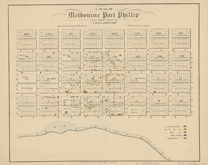


Image 9
J. Williamson, “A Plan of Melbourne Port Phillip from actual survey by J. Williamson, Sur., R. Clint Engraver,” ca. 1839. Photo-lithographed by H.J. Green Government Printer, 1937
Maps Collection, State Library of VictoriaDemonstrating the flexibility of the modular system, Melbourne’s grid quickly expanded, as documented in John Williamson’s printed map of 1839 based on his “actual survey.” This plan demarcates buildings and blocks reserved for public institutions, including schools, markets, the Customs House, Court House, and future Reserve. With every lot and block numbered, the plan manifests its role in the real estate development of this colonial settlement.
© 2015 Museum of the City of New York all rights reserved