Before
The Grid
The
1811 Plan
BUILDING
THE GRID
19TH-CENTURY
DEVELOPMENT
20th century–
Now
living on
the grid
other
Grids
19th-Century Development
Third to Fifth Avenue, Insurance Map, 1892
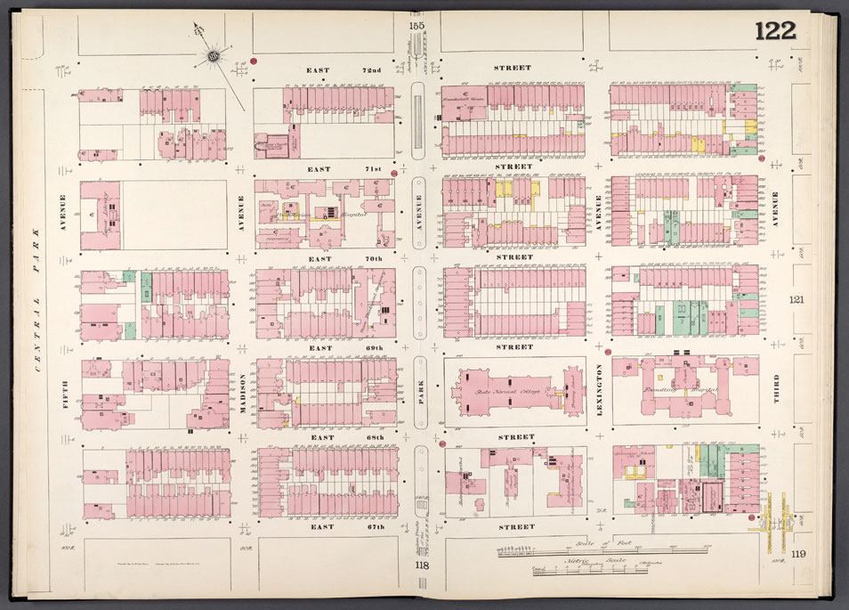


Image 2
D. A. Sanborn Map Company, insurance map, Manhattan, vol. 6, plate 122: Map bounded by East 72nd Street, Fifth Avenue, East 67th Street, 3rd Avenue, 1892
The Lionel Pincus and Princess Firyal Map Division, The New York Public Library, Astor, Lenox and Tilden FoundationsIn 1889 the D. A. Sanborn Map Company, established roughly two decades earlier, absorbed Perris & Browne’s venture. Sanborn developed over 100 symbols to provide an even greater level of detail for insurers. This 1892 map illustrates several public improvements that spurred construction: Madison and Lexington Avenues have been opened, and Fourth Avenue has become Park Avenue, landscaped and lined with homes and other institutions.
The post–Civil War economic boom generated a period of active brownstone construction on the East Side, visible on the map as small, red rectangles. Larger red shapes line Fifth Avenue, which is beginning to host a procession of elite buildings. AR
© 2015 Museum of the City of New York all rights reserved