Before
The Grid
The
1811 Plan
BUILDING
THE GRID
19TH-CENTURY
DEVELOPMENT
20th century–
Now
living on
the grid
other
Grids
Building the Grid: From Paper to Street, Block and Lot
Lots for Sale in Groups of Six
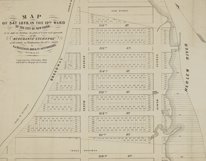


Image 2
“Map of 547 Lots, in the 12th Ward of the City of New York, to be sold at Auction, in plots of 6 lots and upwards at the Merchants’ Exchange,” by A. J. Bleecker, Son & Co., Auctioneers, 1859
Museum of the City of New York, The J. Clarence Davies Collection, 29.100.3045This plan extends the grid to the northern tip of Manhattan, from 211th to 216th Street, and shows the normative grid subdivision: a standard block, 800 by 200 feet, is divided into lots of 25 by 100 feet, yielding 64 lots per block. When the commissioners stopped the grid at 155th Street, they aimed to avert speculation on land they thought unamenable to development. This map confirms their fears. East of Ninth Avenue, the map projects the subdivision of nonexistent land, on landfill in the Harlem River. Most of the depicted area is now occupied by a subway yard.
© 2015 Museum of the City of New York all rights reserved